Lost in Jakarta’s Wild Side: Where Concrete Meets Jungle
You know what I didn’t expect in a megacity of over 10 million? Rivers snaking through urban jungles, crumbling colonial ruins half-swallowed by vines, and hills that rise like secrets in a sea of chaos. Jakarta isn’t just traffic and skyscrapers—this city pulses with wild, untamed terrain hiding in plain sight. I went exploring, and honestly? My mind was blown. Come see the side of Indonesia’s capital nobody talks about.
Beyond the Bustle: Rethinking Jakarta’s Landscape
Jakarta is often painted with a broad brush: a sprawling, traffic-choked capital where concrete seems to have won the war against nature. But look closer, and a different story unfolds—one of rivers carving through dense neighborhoods, pockets of forest thriving in unexpected corners, and subtle elevation shifts that create microclimates within the urban heat. Far from being a flat, lifeless expanse, Jakarta occupies a complex ecological and geological crossroads. Built on sediment-rich coastal plains at the edge of Java, the city sits where mountain-fed rivers meet the Java Sea, forming a dynamic interface between land and water. This position has shaped not only its history but also its present terrain, which remains in constant dialogue with natural forces.
While Bali and Yogyakarta draw tourists with their temples and beaches, Jakarta’s landscape is quietly gaining attention among urban ecologists and adventurous travelers. The city spans over 660 square kilometers, yet within that footprint lies a surprising diversity: from low-lying northern districts prone to tidal flooding to slightly elevated southern zones that host leafy residential areas and green hills. These differences are not merely aesthetic—they influence air quality, temperature, flood risk, and even lifestyle. Understanding Jakarta’s terrain means moving beyond the stereotype of endless asphalt and recognizing the city as a living, breathing ecosystem, constantly negotiating with water, soil, and vegetation.
What makes Jakarta particularly fascinating is its resilience. Despite rapid urbanization and environmental pressures, nature persists. Mangroves cling to riverbanks, birds nest in parkland canopies, and community gardens flourish in vacant lots. This coexistence isn’t accidental—it’s the result of both natural adaptation and growing civic awareness. Urban planners, environmental groups, and residents are increasingly recognizing the value of these green corridors and elevated zones, not just for beauty, but for survival. In this light, Jakarta emerges not as a city overwhelmed by chaos, but as one engaged in a daily act of balance—between development and preservation, between sinking ground and rising ambition.
The City That Sinks and Swells: Jakarta’s Ground Reality
One of the most defining—and alarming—features of Jakarta’s terrain is its gradual descent into the sea. The city is sinking faster than almost any other in the world, with some areas subsiding up to 25 centimeters per year. This phenomenon, known as land subsidence, is largely driven by excessive groundwater extraction, as millions rely on underground aquifers for daily use. Add to that the pressures of rising sea levels and inadequate drainage, and the result is a city fighting to stay above water—literally. Entire neighborhoods in North Jakarta, such as Muara Baru and Penjaringan, now sit below sea level, accessible only via elevated walkways during high tide.
This ongoing subsidence has fundamentally altered the city’s topography. Streets that were once level now slope unpredictably; buildings tilt; and seasonal floods have become more frequent and severe. In some districts, residents stack sandbags year-round, treating flooding not as an emergency but as a seasonal rhythm. The government has responded with large-scale engineering projects, most notably the National Capital Integrated Coastal Development (NCICD) plan, which includes the construction of a massive sea wall—dubbed the Giant Sea Wall—designed to protect the northern coastline. While still under development, this structure aims to reclaim land and create a new urban buffer zone between the city and the sea.
Yet, amidst the crisis, innovation thrives. Elevated roads and floodgates now crisscross vulnerable areas, and new housing developments incorporate raised foundations and rainwater harvesting systems. In some neighborhoods, community-led reforestation efforts have restored green buffers along riverbanks, helping to stabilize soil and reduce runoff. These adaptations are reshaping Jakarta’s physical form, turning urban planning into an act of resilience. The sinking ground is not just a warning—it’s a catalyst for reimagining how cities can live with water rather than fight against it. What was once seen as a flaw in the terrain is now becoming a blueprint for sustainable urban design.
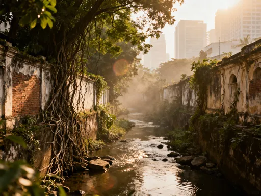
Rivers That Cut Through Chaos: The Lifeblood of the City
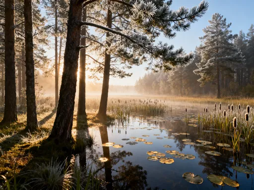
Thirteen major rivers flow through Jakarta, weaving a liquid network beneath the city’s roar. The Ciliwung River, perhaps the most iconic, begins in the volcanic highlands of Bogor and winds over 100 kilometers through dense urban zones before emptying into the Java Sea. These rivers are more than drainage channels—they are natural arteries that shape the city’s layout, culture, and ecology. Historically, they served as trade routes and sources of water; today, they divide districts, influence property values, and support pockets of biodiversity. Along their banks, a quieter Jakarta emerges—one where the hum of traffic fades and the rustle of leaves takes over.
Over the decades, many of Jakarta’s rivers have been lined with concrete to control flooding, a solution that has preserved infrastructure but often at the cost of ecological health. However, recent years have seen a shift in perspective. Environmental groups and local communities are leading clean-up initiatives, removing tons of plastic waste and reintroducing native plants along riverbanks. Projects like the Ciliwung River Festival and the Kali Bersih (Clean River) campaign have brought renewed attention to these waterways, transforming them from neglected zones into spaces of connection and restoration.
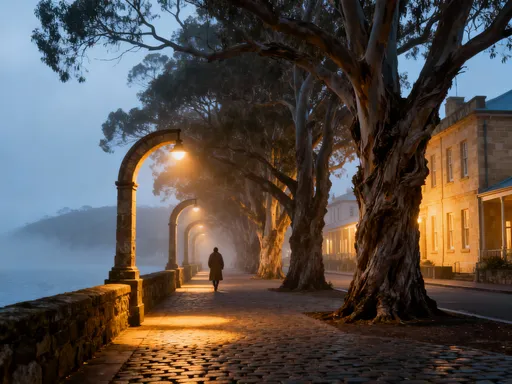
For visitors, exploring these rivers offers a unique way to experience Jakarta’s terrain. Walking trails now line sections of the Ciliwung and Sunter rivers, allowing pedestrians and cyclists to move through shaded corridors far removed from the city’s usual pace. In areas like Kampung Melayu and Tebet, green embankments host small parks, community gardens, and even open-air art installations. These spaces are not manicured in the way of formal gardens—they are rugged, uneven, and alive with movement. Kingfishers dart above the water, monitor lizards bask on rocks, and dragonflies hover over reeds. To walk along these rivers is to witness nature’s quiet persistence, even in the heart of a megacity.
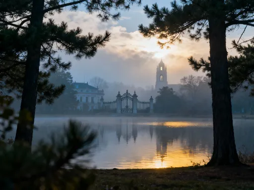
Elevated Escapes: Hills, Parks, and Hidden High Ground
Contrary to popular belief, Jakarta is not entirely flat. While much of the city lies at or near sea level, several districts sit on slightly higher ground, offering cooler temperatures, better air circulation, and panoramic views. Areas like Kemang, Pondok Indah, and Cipete in South Jakarta are built on gentle slopes, remnants of ancient geological uplifts that predate urban development. These elevated zones were historically favored for colonial-era homes and now host some of the city’s most desirable residential neighborhoods. Their height—often just 20 to 50 meters above sea level—may seem modest, but in a city prone to flooding, even a small rise can mean the difference between dry floors and waist-deep water.
These high points are more than just flood refuges—they are oases of calm. Tree-lined streets, spacious compounds, and well-maintained parks create a sense of openness that contrasts sharply with the density of central Jakarta. Taman Mini Indonesia Indah, located in East Jakarta, features carefully landscaped hills that represent the diverse topography of the Indonesian archipelago. While man-made, these slopes offer real elevation changes, making them ideal for walking, jogging, or simply enjoying a breeze away from the city’s heat. Similarly, the southern edge of Ragunan Zoo borders a forested area that slopes gently into the Depok region, where secondary growth and birdlife thrive.
For families and outdoor enthusiasts, these elevated spaces provide accessible nature experiences without leaving the city. Weekend visitors often gather at parks like Lebak Bulus or Fatmawati Green Park, where children play on grassy lawns and adults practice tai chi or yoga on open plazas. Some residents even grow small fruit trees or herbs in their yards, taking advantage of the better-draining soil. These areas demonstrate how subtle changes in terrain can have a profound impact on quality of life, offering not just physical relief from floods and heat, but emotional relief from urban stress. In a city that never stops moving, these quiet hills are places to pause, breathe, and reconnect with the earth.
Urban Jungles and Green Arteries: Nature’s Comeback
Amid Jakarta’s relentless development, nature is staging a quiet comeback. Along river corridors, abandoned lots, and the edges of residential zones, patches of jungle-like vegetation are reclaiming space. The Cipinang River area, once heavily polluted and overbuilt, now hosts stretches of dense greenery where ferns, bamboo, and banyan trees grow unchecked. Suarabaya Park, a revitalized green space in Central Jakarta, integrates natural terrain into its design, with winding paths that follow the land’s contours and native plants that attract pollinators. These are not sterile, perfectly trimmed lawns—they are wild, slightly untamed spaces where roots crack through pavement and vines climb old walls.
What makes these green arteries special is their organic growth. Unlike formal parks, they evolve naturally, responding to seasonal rains, soil conditions, and animal activity. Birds such as the Javan myna, black-naped oriole, and collared kingfisher have returned to these zones, building nests in tall trees. Insects, butterflies, and even small reptiles find shelter in the underbrush. For residents, these spaces offer more than shade—they provide a sense of wonder, a reminder that life persists even in the most unlikely places.
Kuningan City Park, nestled in one of Jakarta’s busiest business districts, exemplifies this blend of urban and wild. Designed with gentle slopes and native vegetation, the park follows the natural lay of the land, creating micro-environments that vary in sunlight and moisture. Morning walkers often spot monitor lizards slipping into drainage ditches or hear the call of the pied shrikebill from the canopy. The park’s success has inspired similar projects across the city, proving that green spaces don’t need to be large to be meaningful. Even small pockets of vegetation can become vital refuges for both wildlife and people, enhancing air quality, reducing noise, and improving mental well-being.
Exploring the Edges: From Wetlands to City Limits
The full story of Jakarta’s terrain unfolds not in its center, but at its edges—where the city blurs into countryside, wetlands, and sea. To the north, coastal mangroves stretch along the shoreline, their tangled roots stabilizing the soil and protecting against erosion. The Muara Angke Wildlife Reserve, one of the last remaining mangrove forests in Jakarta, is home to threatened species like the proboscis monkey and the milky stork. Though small in size, this reserve plays a crucial role in maintaining ecological balance and offers guided tours for visitors interested in birdwatching and conservation.
To the east, the landscape opens into rice fields and river deltas, where traditional farming continues alongside urban expansion. Towns like Bekasi and Cikarang mark the transition from city to suburb, where paddy fields give way to factories and housing complexes. Yet, even here, water remains a dominant force—irrigation canals crisscross the land, and seasonal flooding shapes agricultural rhythms. For travelers, day trips to these areas offer a glimpse into a different way of life, one still tied to the land and its cycles.
To the south, the highlands of Bogor loom close, their cooler climate and forested slopes a stark contrast to Jakarta’s heat. Mount Salak and Mount Pancar are within easy reach, offering hiking trails, hot springs, and views over the sprawling metropolis below. The Thousand Islands, a chain of small islets north of Jakarta Bay, provide another escape—white-sand beaches, coral reefs, and clear waters just a few hours by boat. These destinations remind us that Jakarta’s terrain does not end at administrative borders. The city is part of a larger geographical system, shaped by rivers, tides, and elevation changes that extend far beyond its skyline.
How to Explore Jakarta’s Terrain Like a Local
Exploring Jakarta’s terrain doesn’t require special equipment or expert knowledge—just curiosity and a willingness to look beyond the obvious. Start with early morning walks along riverfront trails, when the air is cool and the light filters softly through the trees. The Ciliwung River path between Tebet and Manggarai is well-maintained and safe, offering views of lush banks and passing boats. For a longer adventure, rent a bicycle and ride through quieter districts like Menteng or Cipete, where tree-covered streets and gentle slopes make for pleasant cycling.
Public transportation can also take you to hidden natural spots. The TransJakarta busway has stops near Taman Mini and Ragunan, while commuter trains reach Bogor in under an hour. Once there, you can hike into the forested hills or visit the famous botanical gardens. For coastal experiences, ferries depart regularly from Ancol Marina to the Thousand Islands, with options for day trips or overnight stays on family-friendly resorts.
Technology can enhance your exploration. Google Maps now includes elevation data, allowing you to identify hills and valleys in the city’s layout. Apps like AllTrails list walking and hiking routes in and around Jakarta, complete with photos and user reviews. But perhaps the best tool is conversation. Talk to drivers, shopkeepers, or park visitors—they often know the best spots for sunset views, quiet woods, or hidden streams. Many locals enjoy sharing their favorite escapes, whether it’s a quiet hill in South Jakarta or a community garden tucked behind a busy market.
When planning your outings, wear comfortable shoes, bring water, and dress in breathable clothing. Mornings are ideal for outdoor activities, as temperatures rise quickly after 10 a.m. Always stay on marked paths in protected areas, and avoid visiting during heavy rains, when flooding can occur. With a little preparation, even a short visit can turn into a meaningful exploration of Jakarta’s surprising landscape.
Jakarta’s Terrain—A Story of Resilience and Discovery
Jakarta’s land is unstable, ever-changing, and full of surprises. It sinks, floods, and rebuilds—but it also grows, rises, and adapts. To explore its terrain is to witness resilience in action. Beyond the noise and rush lies a city shaped by nature’s forces, offering quiet jungles, hidden hills, and rivers that refuse to be tamed. This isn’t just a capital city. It’s a living landscape—and one worth discovering, one step at a time. For families, travelers, and everyday residents, Jakarta’s wild side offers not just escape, but connection: to nature, to community, and to the quiet strength of a city that keeps rising, no matter what the ground beneath it does.